
Summary
During this interactive lesson, students will explore various map types, learn about the different features of maps, hone in on the unique qualities of their state's maps, and create their very own maps of the state of Oklahoma.
Essential Question(s)
How can understanding the parts of a map help you identify where you are in relation to another point on the map?
Snapshot
Engage
Students engage in a Card Sort activity to organize words, definitions, and images representing various aspects of a map.
Explore
Students explore a variety of different map types and their usefulness in providing key information.
Explain
Students analyze the text in an interactive book that is designed to explain the various aspects of maps.
Extend
Students participate in an interactive read-aloud of "S is for Sooner: An Oklahoma Alphabet," by Devin Scillian, in which they take turns applying new skills to create a classroom map of Oklahoma.
Evaluate
Students take the information that they have learned throughout the lesson and construct their own maps of the state of Oklahoma.
Materials
Lesson Slides (attached)
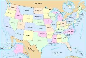
Printed Oklahoma, United States, and World maps (attached; one copy each per classroom)
Card Sort cards (attached; one set per pair of students)
It's OPTIC-AL handout (attached; one per student)
Oklahoma Map Books (attached; one per student)
"S is for Sooner: An Oklahoma Alphabet" by Devin Scillian
"S is for Sooner" map cards (attached; one set per classroom)
Student Work Samples (attached; one per teacher)
Large classroom map of Oklahoma
Magnets, tape, double-sided tape, or hook and loop fasteners (for hanging maps and map cards)
Stapler
Globe
Compass
Paper
Markers, crayons, or colored pencils (Red, Pink, Orange, Green, Blue, Purple, Black)
Pencils
Highlighters
Engage
Use the attached Lesson Slides to guide the activities and instruction. Display slide 2 and tell students that they are going to participate in a Card Sort activity. During the activity, students will work with a partner to match content-related words to their definitions or pictures. This activity will help students organize their prior knowledge about maps and show any misconceptions they might have.
Students should spend no more than 10–15 minutes on the card sort because it is intended as a quick assessment of prior knowledge. However, let them know that they will revisit it later in the lesson, so if they aren't sure what the meaning of a word is, that's okay!
Display slide 3 and share the essential question with students: How can understanding all aspects of a map help you identify where you are in relation to another point on the map?
Share the lesson objectives on slide 4.
Explore
The Explore activity combines the Gallery Walk and It's OPTIC-al instructional strategies. As students move from station to station, viewing different types of maps of Oklahoma, the United States, and the world, they have the opportunity to explore maps that represent a variety of topographical and physical features, land regions, and political borders. This exposure prepares students to have voice and choice in which map they'd like to analyze further in the second part of the activity.
Display slide 5. Distribute students equally among the maps hung around your room. Tell groups that they will circulate around the room, stopping at each map long enough to evaluate it. Draw students' attention to the four questions on the slide, which they should consider with their groups as they view each map.
Begin the Gallery Walk, giving students approximately one minute to spend at each map image before rotating to the next map. Continue until all of the groups have completed the circuit.
Once students have completed the circuit, debrief as a whole class by having students reflect on what they observed using the questions on slides 6–9:
What information did you see on the maps that was helpful? How was it helpful?
What information did you notice was missing? How did not having that information affect your understanding of a map?
What information would be helpful if you had it? How would that have helped improve your understanding?
What information was confusing to you? What do you think was causing this confusion? How might a map author make changes to help you better understand the information?
Display slide 10. Ask students to select one map that they'd like to analyze further, and then pass out a copy of the It's OPTIC-AL handout to each student.
Looking at the map that they chose, students should follow the prompts on their handouts to describe the following:
O - Observations: What do students notice about the map?
P - Visual Parts: What details make this map unique?
T - Title: What is the title? How does it relate to the map as a whole? If it doesn't have a title, what would be a good title for the map?
I - Interrelationships of the Visuals: How do all of the pieces of this map work together to help students understand what it's telling them?
C - Conclusions: How might this map be helpful to someone?
Explain
Display slide 11. Students will use the CUS and Discuss strategy as they read through the Oklahoma Map Book handout. Students should:
C - Circle new words.
U - Underline details that support the main idea of each section.
S - Star the main idea of each section.
Each page of this book is interactive and will help explain the purposes of maps, different types of maps, definitions associated with reading maps, and more. As they read, your students should be circling new words, underlining details that support the main idea of each section, and starring the main ideas of each section. Students can either read through the document once before reading through it again to mark it up, or they can mark important parts of the text as they read through it the first time; this is an instructional decision for you to make based on the needs of the class.
Display slide 12. As they finish reading, have the students pair up to discuss what they circled, underlined, and starred, as well as their responses and interactions with the book. Then, have them revisit their card sorts and see if their responses have changed. They can use their map books to help them justify any changes that they might want to make.
Extend
Display slide 13. Now that students have a good understanding of maps and their various purposes, read aloud the book S is for Sooner: An Oklahoma Alphabet by Devin Scillian. During the read-aloud, pause so that students can interact with the map of Oklahoma using the S is for Sooner Map Cards provided in the attachments. Use these cards to label locations mentioned throughout the book on your classroom's state map.
Once you have completed the read-aloud of the book, take a moment to view the completed map. Pose the following question to your class: "Have we left anything off?"
Evaluate
Display slide 14. Using what they have learned, have your students create a One-Pager depicting what they believe to be the most important information from the lesson. A one-pager allows students to express their overall comprehension of a subject through a variety of methods. Students use one side of a piece of paper to demonstrate comprehension through writing, drawing, and other forms of expression. Let your students know that, on one side of the paper, all of their work should be colored and completed neatly in pencil. When creating their one-pager, students should include four or more of the following:
Write the title of the unit somewhere prominent on the page.
Draw a border around the page that represents the theme of the unit (this can be words, symbols, or phrases).
Sketch at least one image (but, more are encouraged!) that represents something they learned during the lesson.
Describe one of the visuals that they drew with a word cluster around it.
Write a personal statement that evaluates the lesson. (e.g., "I enjoyed this lesson, because...", or "I didn't enjoy this lesson, because...")
Develop three or more written questions. These questions should each come with the correct answer included.
Write a poem that summarizes important information learned in the lesson.
The Student Work Samples attachment includes examples of one-pagers created by students about the state of Washington.
Resources
K20 Center. (n.d.). Card sort. Strategies. https://learn.k20center.ou.edu/strategy/d9908066f654727934df7bf4f506976b
K20 Center. (n.d.). CUS and discuss. Strategies. https://learn.k20center.ou.edu/strategy/d9908066f654727934df7bf4f5073969
K20 Center. (n.d.). Gallery walk/carousel. Strategies. https://learn.k20center.ou.edu/strategy/d9908066f654727934df7bf4f505a54d
K20 Center. (n.d.). It's OPTIC-al. Strategies. Retrieved from https://learn.k20center.ou.edu/strategy/b30762a7557ba0b391f207f4c600eac6
K20 Center. (n.d.). One-Pager. Strategies. https://learn.k20center.ou.edu/strategy/7b4de59085f566aa097814b8c0009edd
Scillian, D. & Radzinski, K. (2003). S is for Sooner: An Oklahoma alphabet. Ann Arbor, MI: Sleeping Bear Press.